So today I'm going to tell you about the walk I went on yesterday. (This isn't necessarily of any interest to anyone, but this is my web log and I'll do what I like with it.)
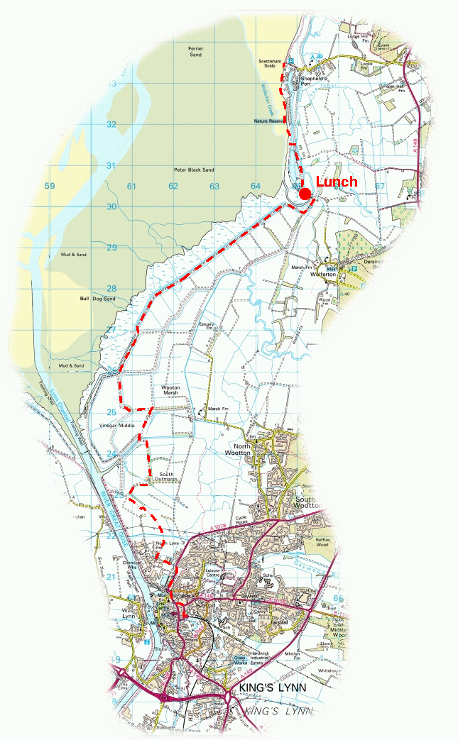
We went to Kings Lynn, which is the town at the mouth of the Great Ouse at the southern end of The Wash, with the intention of walking to Hunstanton. This was optimistic. We didn't make it quite that far. You can see an approximate map of our route. Image produced from the Ordnance Survey Get-a-map service. Image reproduced with kind permission of Ordnance Survey and Ordnance Survey of Northern Ireland.
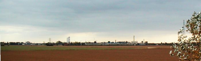
Kings Lynn, years ago an important port, seemed an ugly town replete with chemical works, oil depots, one-way systems, intermittent train services and sundry other modern inconveniences, though the center of the town is apparently very attractive, with many fine buildings. We cleverly avoided seeing any of these by immediately heading north out of town and making an erroneous detour through an industrial estate. At almost any distance from the town, it's that which dominates the skyline:
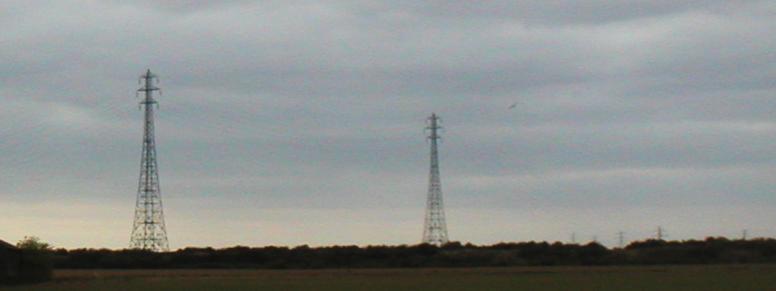
North Norfolk isn't known for its hills, and anything which sticks any distance above the ground is visible for miles. These electricity pylons, carrying cables high enough over the mouth of the Great Ouse that ships can pass safely underneath, can be seen for miles around:
For most of the walk, we followed the sea bank (flood defence) along the shore of the Wash. On one side is salt marsh, and on the other arable land reclaimed from the sea over the past four centuries.
Strictly speaking this is private land, though many web pages about walking this part of the coast mention walking this way without trouble. We were accosted once by a chap in a Land Rover, who pointed out that we were not on a right of way. He was, I think, under the impression that we were lost -- although we were walking purposefully in a straight line, equipped with a map, and by this stage we were five miles from any road -- and he conceded -- after a short and uninformative conversation -- that our quickest way back to civilisation was to continue in the same direction. He also warned us against straying onto the Sandringham Estate, despite the fact that doing so would have required going off course by about 90° for a distance of several miles. I guess we must have looked pretty clueless, which was exactly the impression we were trying to create. (And we didn't get shot, either, for which small mercy much thanks.) Naturally if we'd been challenged again we would have explained that we were acting under previous instructions, but this didn't occur.
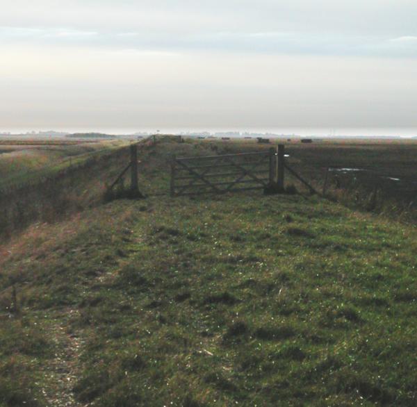
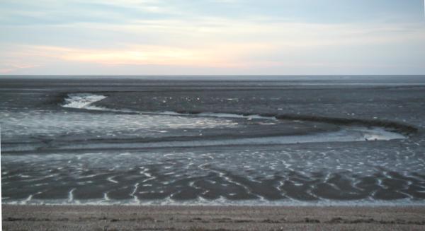
The sea banks are about ten foot above their surroundings, and are not the easiest of walking surfaces. It's usual to describe the surrounding landscape as `bleak'. Here's a picture, looking along the bank:
Even in an essentially flat landscape, walking along a path raised above the surroundings, it's necessary to consult a map...
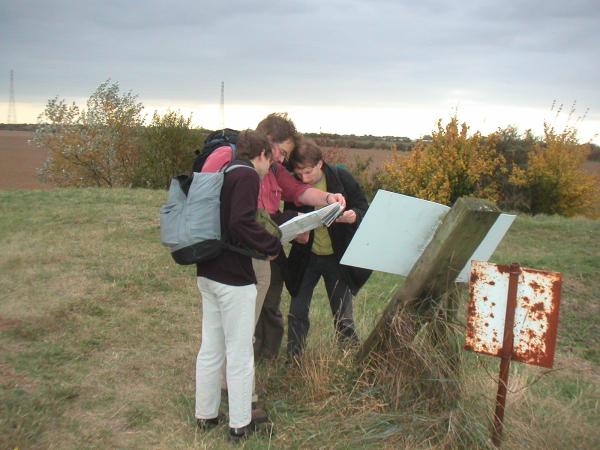
... regularly...
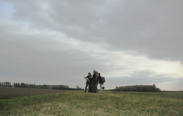
... if you don't want to get lost.
Looking inland, you see something like this:

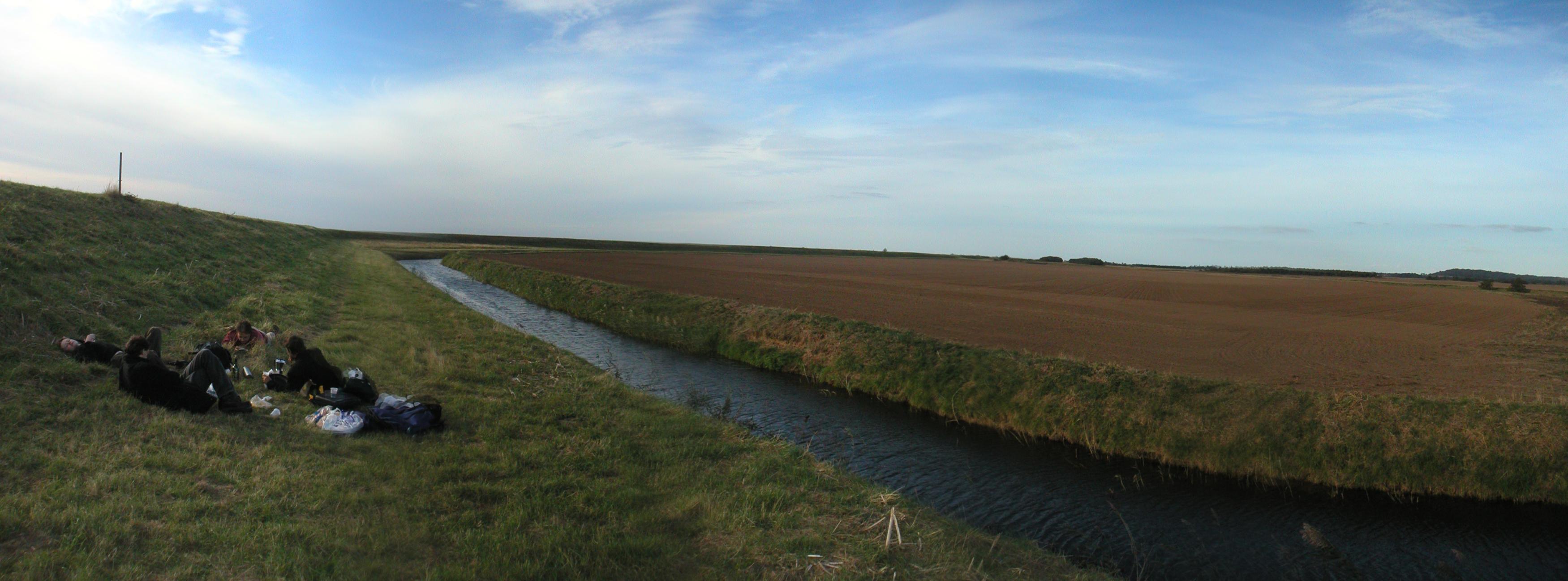
Apologies for crummy panorama. Mark refers to this technique, rather scathingly, as `the poor man's wide-angle lens', which is about right. He's also much better at sticking the images together than I am. For those Windows users out there who'd like an opportunity to laugh at the current advanced state of free software user-interface design, you can have a look at these rather disheartening instructions on assembling composite images using the GIMP Photoshop-alike, paying particular attention to the bit where you're supposed to tabulate colour values and manually construct transfer functions to match images up with one another. Plainly, even UNIX users aren't living in the future yet.... And a word of advice to others taking panoramas -- don't try putting a ploughed field in the foreground. It will only cause you misery.... There are some much more impressive examples on the website about David Cotton's six-thousand-odd mile walk around the entire coastline of Great Britain. (Comments about fractal dimension probably not appreciated.)
Eventually, we got bored of walking and stopped for lunch. Oddly enough, this was at exactly the same time that we reached a public footpath where we thought the chances of a shotgun-toting farmer objecting to our cooking stuff were small enough to take the risk. None of us actually live in Islington, but you might be forgiven for thinking otherwise:
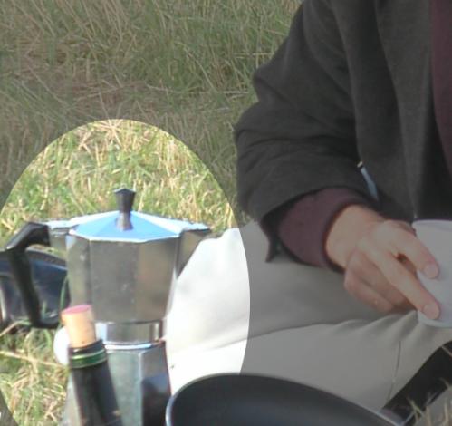
(Not quite as bad as the time when, at my birthday party, somebody put out a small barbecue-related fire with mineral water. ``Dial 999-1 for Islington Emergency Services.'')
Further north the coast path follows the shoreline, offering charming views of the mud which caused King John so much trouble:
This is also the location of the Snettisham nature reserve, home to ducks and geese in large numbers. (Further south they shoot them.)
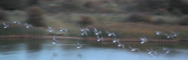
(By this point it was quite dark, hence rather long exposure in that photo....)
The mud is also, apparently, where you park your yacht (if you have one):
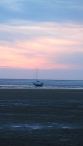
At the end of the walk, we watched the sunset at Shepherd's Port (a depressing encampment of caravans and `Residents Only' signs that's just begging for a tornado or other appropriate natural disaster) and got a taxi back to Kings Lynn. This is, of course, cheating. But what's wrong with that?