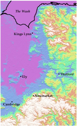
OK, that's enough of that. I was impressed that two people got the right answer (Tom wasn't far off, either). Here's a labelled map:
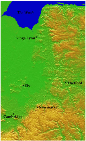
and one with slightly more conventional colouring:
The data come, incidentally, from the Shuttle RADAR Topography Mission, which, pace Maciej Ceglowski, is one of very few useful things that've been done with the shuttle. The reason I was looking at this in the first place was equally as silly as the map itself. I remember being told years ago something like,
if you draw a line eastwards from the top of Castle Hill in Cambridge, the first time it crosses higher ground is when it reaches the Urals
-- this theory being advanced as explanation for Cambridge's lousy winter weather. It's nonsense, of course, topographically and meteorologically. That didn't stop me wondering what the actual topographic profile looks like. Here it is:
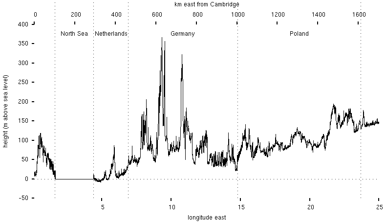
The Urals lie a further two thousand or so kilometers to the east.